Emily Zhou

Masters of City Planning Candidate at University of Pennsylvania
This site is maintained by emilyzhou112.
Environmental Assets in Coastal Maine Watersheds
Overview
As a resident, it is easy to look at the planning world in terms of two opposing forces: conservation and development, or rather what should be set aside for some purposes and what should be used for some purpose. These are, of course, reductive and ambiguous terms (i.e. used for what or for whom?), but the core conflict arises again and again. A group of ornithologists may rightly object to the development of a parcel where there are known nesting sites of endangered birds, whereas a developer may well have good intentions for wanting the most financially feasible place to site affordable housing for working class families. The subject has more variables and constraints than might seem reasonable to analyze, but a baseline understanding of natural resources is usually part of every town’s Comprehensive Plan (Meader, 2021).
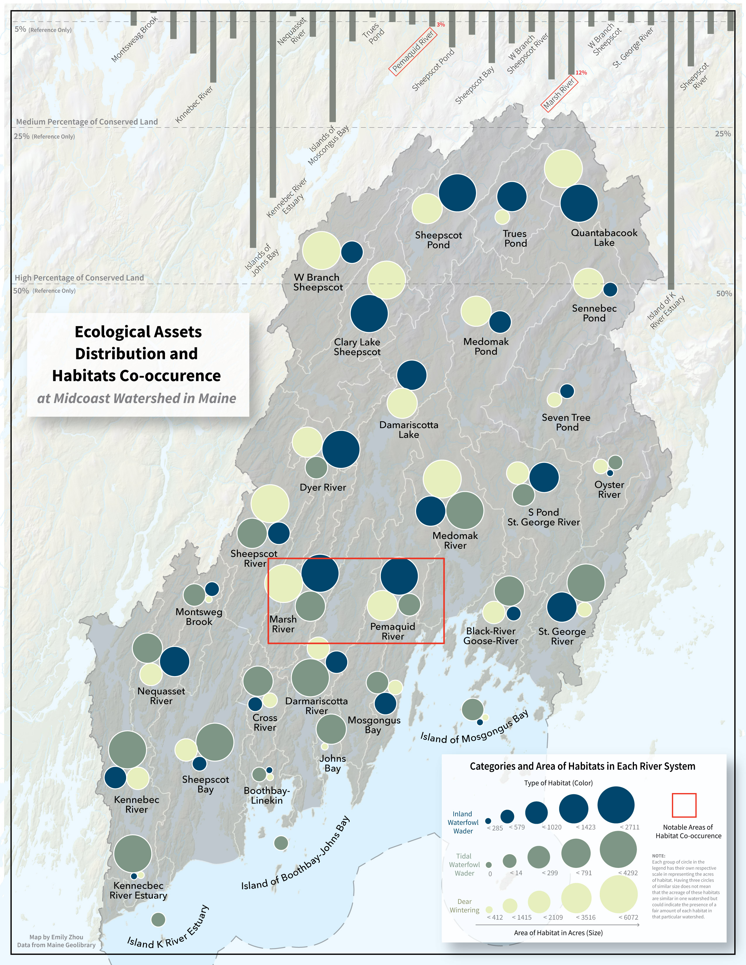
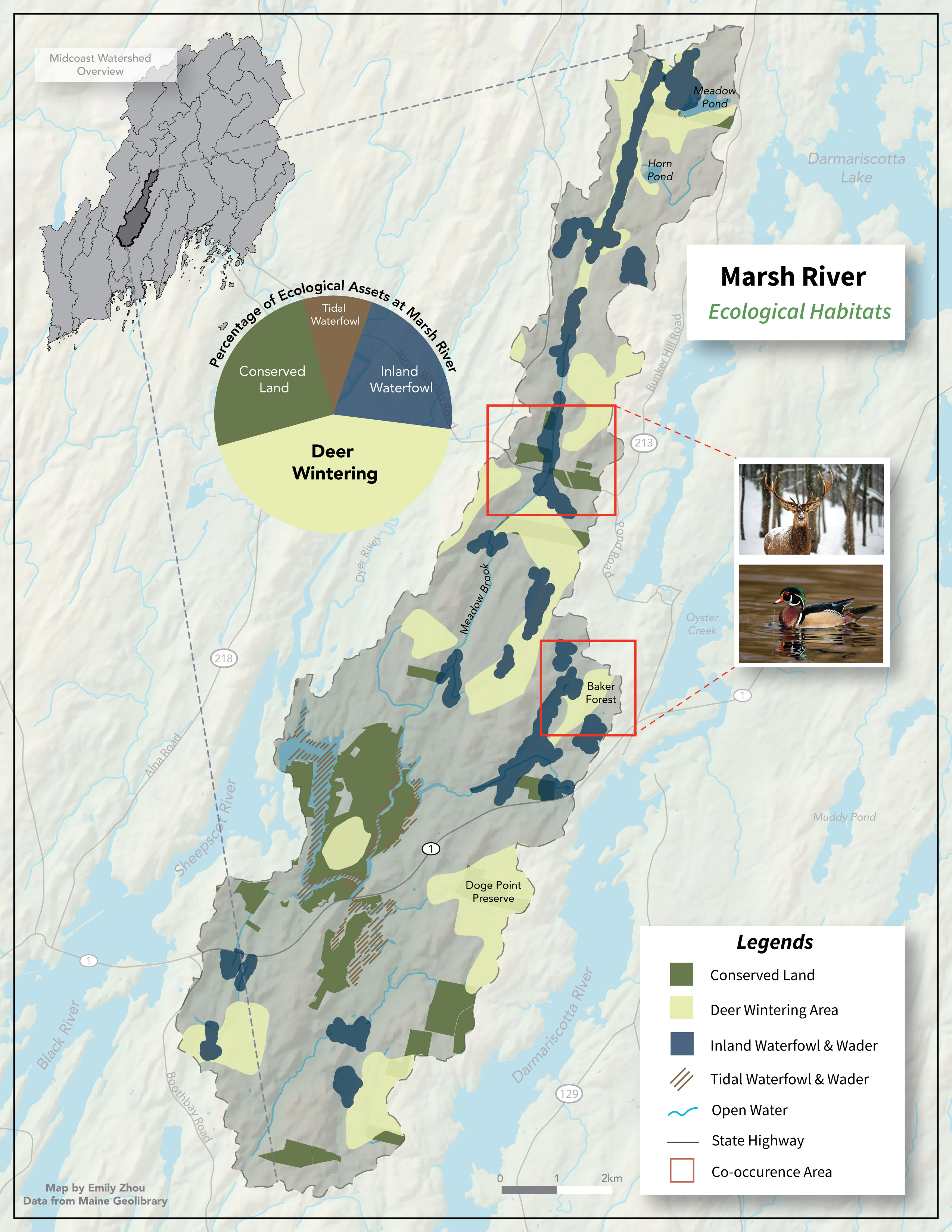
This mapping exercise investigates the ecological assets of a series of watersheds in coastal Maine. The target audience is considered to be “residents” or the “public,” and the target clients are a collaborative of land trusts who are working together to identify areas that should be targeted for additional conservation efforts. After learning a few basic summarization and visualization tools in QGIS, I created visualizations that provide context for community members regarding conservation—that is, can we tell a story about which watersheds or areas would be best targeted for future conservation?
Big Ideas
Technical — Overlap analysis, chart symbols, terrain tools, Tableau Public.
Conceptual — Workflow efficiency, pixel gradient symbology, multipart/singlepart geometry, scale, terrain representation.
Softwares
Data
- All vector data were downloaded from the Maine Geolibrary.
- The DEMs were downloaded, mosaicked and clipped from the National Map.
- The “Undeveloped Blocks” dataset is from Beginning with Habitat, and the landcover dataset is from the National Oceanic and Atmospheric Administration (NOAA).
Maps